File:Middle-Earth map 4 lands.png
Jump to navigation
Jump to search

Size of this preview: 800 × 600 pixels. Other resolution: 2,400 × 1,800 pixels.
Original file (2,400 × 1,800 pixels, file size: 7.82 MB, MIME type: image/png)
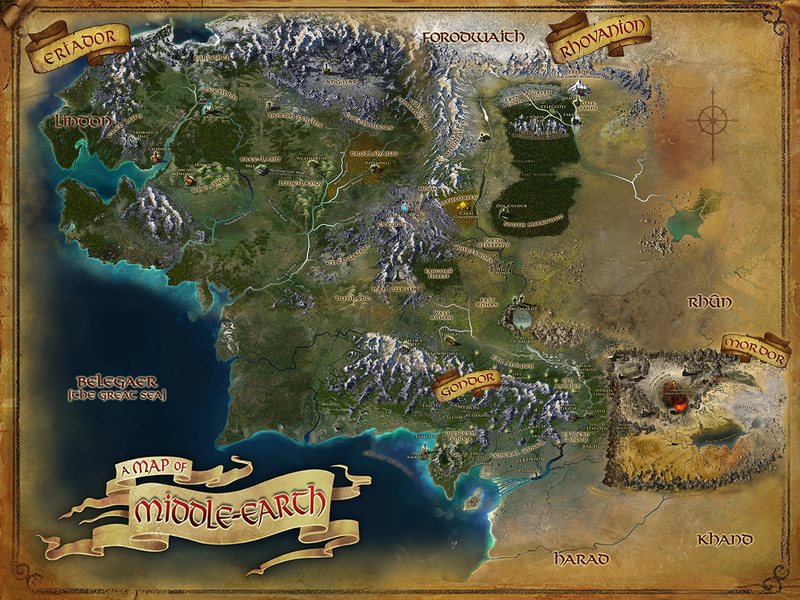
A composite map of Middle-Earth by User:Varghedin created by combining the in-game map of Middle-Earth with the in-game maps of the four lands (Eriador, Rhovanion, Gondor and Mordor).
File history
Click on a date/time to view the file as it appeared at that time.
| Date/Time | Thumbnail | Dimensions | User | Comment | |
|---|---|---|---|---|---|
| current | 08:00, 22 May 2019 | | 2,400 × 1,800 (7.82 MB) | Varghedin (talk | contribs) | Smaller file to fix size error |
| 06:39, 22 May 2019 |  | 3,733 × 2,800 (17.23 MB) | Varghedin (talk | contribs) |
You cannot overwrite this file.
File usage
The following 2 pages use this file: